
Page 176 - THE ONTARIO CURRICULUM, GRADES 9 AND 10 | Canadian and World Studies
P. 176
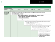
        1. MAP AND GLOBE SKILLS (continued)
           B. Spatial Representation
     Grades 11–12
       The student:
  • extracts information from and creates sketch maps (e .g ., showing a local neighbourhood, the layout of a classroom)
• creates 2D maps of familiar surroundings
• creates 3D models using blocks and toys
       • extracts information from, analyses, and creates thematic maps, including the following:
− political (e .g ., Canada’s political regions, countries of the world)
− physical (e .g ., climate, landforms)
− historical (e .g ., settlement patterns)
− land use (e .g ., community features)
• extracts information from, analyses, and creates digital maps (e .g ., online interactive)
  • extracts information from, analyses, and creates thematic maps, including the following:
− flow (e .g ., movement of people)
− issue-based (e .g ., pollution or poverty in Canada)
− annotated (e .g ., illustrating an aspect of student inquiry)
− demographic (e .g ., population distribution)
  • extracts information from, analyses, and creates increasingly
− demographic (e .g ., population density, literacy rates) complex thematic maps, including the following:
− physical (e .g ., frequency of natural events)
• extracts information from and analyses topographic maps
   • extracts information from, analyses, and creates increasingly complex thematic
maps, including the following:
issue-based maps layering two or more
themes (e .g ., population density and
CO emissions;populationsettlement 2
and weather events)
   Grade 9
   Grades 7–8
       Grades 4–6
      Grades 2–3
      Grade 1
       CATEGORY
  Map types (e.g.,
sketch, thematic,
topographic)
 Appendix C
 174
