Page 552 - THE ONTARIO CURRICULUM, GRADES 11 AND 12 | Canadian and World Studies
P. 552
        1. MAP AND GLOBE SKILLS (continued)
           B. Spatial Representation (continued)
     Grades 11–12
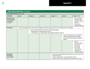
  • usesandcreates appropriate types
of maps to analyse
data and
communicate intended messages
   • extracts information from and analyses photographs of familiar places and sites (e .g ., schoolyard, local community)
       • extracts information from and analyses the following images: − photographs of unfamiliar places and sites
− aerial images (e .g ., satellite images, photographs taken from a plane)
  urban growth, water pollution, vegetation • extracts information from and analyses remote sensing images (e .g ., showing disease)
    • extracts
information/data from various
image types • usesvarious
image types to communicate intended messages
  • selects and uses appropriate base maps for chosen locations and
for specific inquiry
• uses pre-selected layer content required for inquiry
• interprets and analyses information from layers placed on map
   Grade 9
        Grades 7–8
       Grades 4–6
          Grades 2–3
             Grade 1
        CATEGORY
   Map types (e.g.,
sketch, thematic,
topographic)
(continued)
 Image types
    Geographic
information
systems (GIS)
 Appendix C
  550


