
Page 249 - THE ONTARIO CURRICULUM, GRADES 11 AND 12 | Canadian and World Studies
P. 249
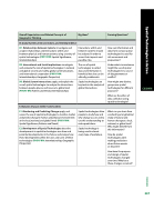
  Overall Expectations and Related Concepts of Geographic Thinking
   Big Ideas*
  Framing Questions*
D. Spatial Systems, Interconnections, and Interdependence
    D1. Relationships between Systems: investigate and analyse relationships and interactions within and between physical and human systems, using a variety of spatial technologies (FOCUS ON: Spatial Significance; Interrelationships)
  Interactions within and between systems should be analysed in order to assess their impacts and possible risks .
 How can information and data from various spatial technologies be used for risk assessment and preparation?
Under what circumstances might the use of spatial technologies be a source of disagreements or conflict?
How might two distinct groups use spatial technologies for different purposes?
What are the ethics of data collection using spatial technologies?
    D2. International and Social Implications: investigate and evaluate the role of spatial technologies in national and global security and safety, global communications, and international cooperation (FOCUS ON: Interrelationships; Geographic Perspective)
    The use of spatial technologies to collect data and information is beneficial but also can be ethically problematic .
  D3. Global System Interactions: apply, and explain the use of, spatial technologies to analyse the interactions between people, places, and issues at a global level (FOCUS ON: Patterns and Trends; Interrelationships)
  Spatial technologies are key tools in the analysis of global interactions .
E. Dynamic Impacts within Communities
    E1. Monitoring and Predicting Change: apply, and assess the use of, spatial technologies to monitor, model, and predict change in human and physical environments at the local, national, and global levels (FOCUS ON: Spatial Significance; Patterns and Trends)
   Spatial technologies allow people to study how and why change occurs and to use this understanding to make predictions .
  What can you learn from conducting a longitudinal study of natural and human change at a local, national, or global level? Who might benefit from this information?
How do spatial technologies aid in making predictions about future events or disasters?
How have the purpose and design of spatial technologies changed over time? Why have these changes occurred?
   E2. Development of Spatial Technologies: describe developments in spatial technologies over time and potential developments in the future, and analyse how these developments affect the uses and users of these technologies (FOCUS ON: Interrelationships; Geographic Perspective)
   Spatial technology is being used in almost every type of workplace .
      OVERVIEW
247
 Spatial Technologies in Action
CGO4M
